Cemeteries
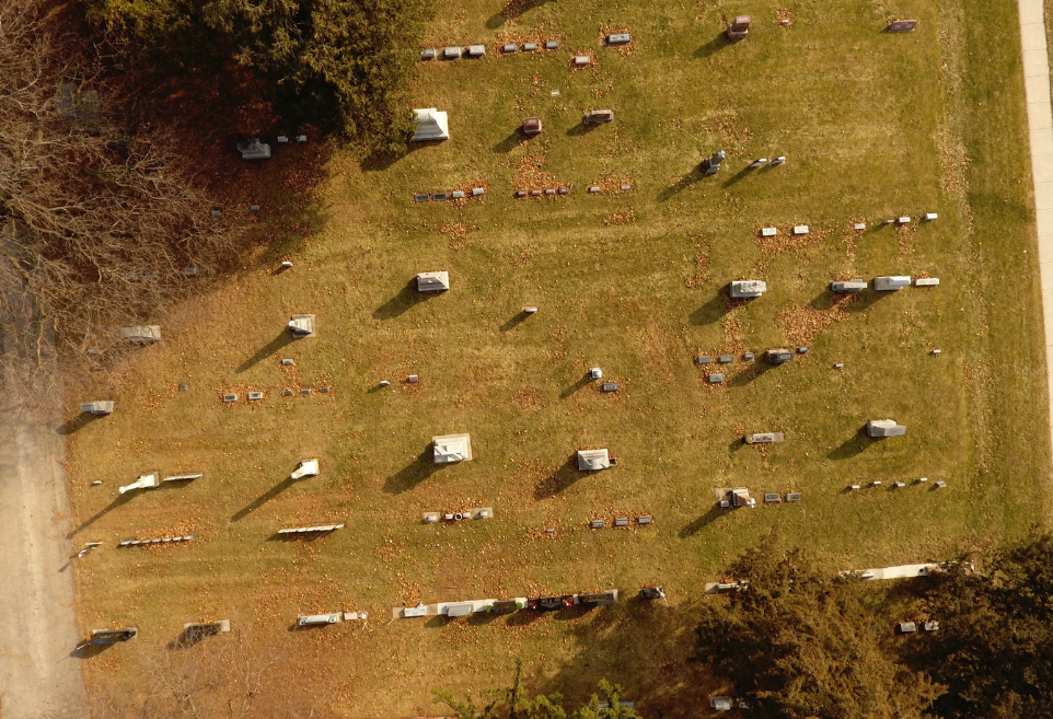
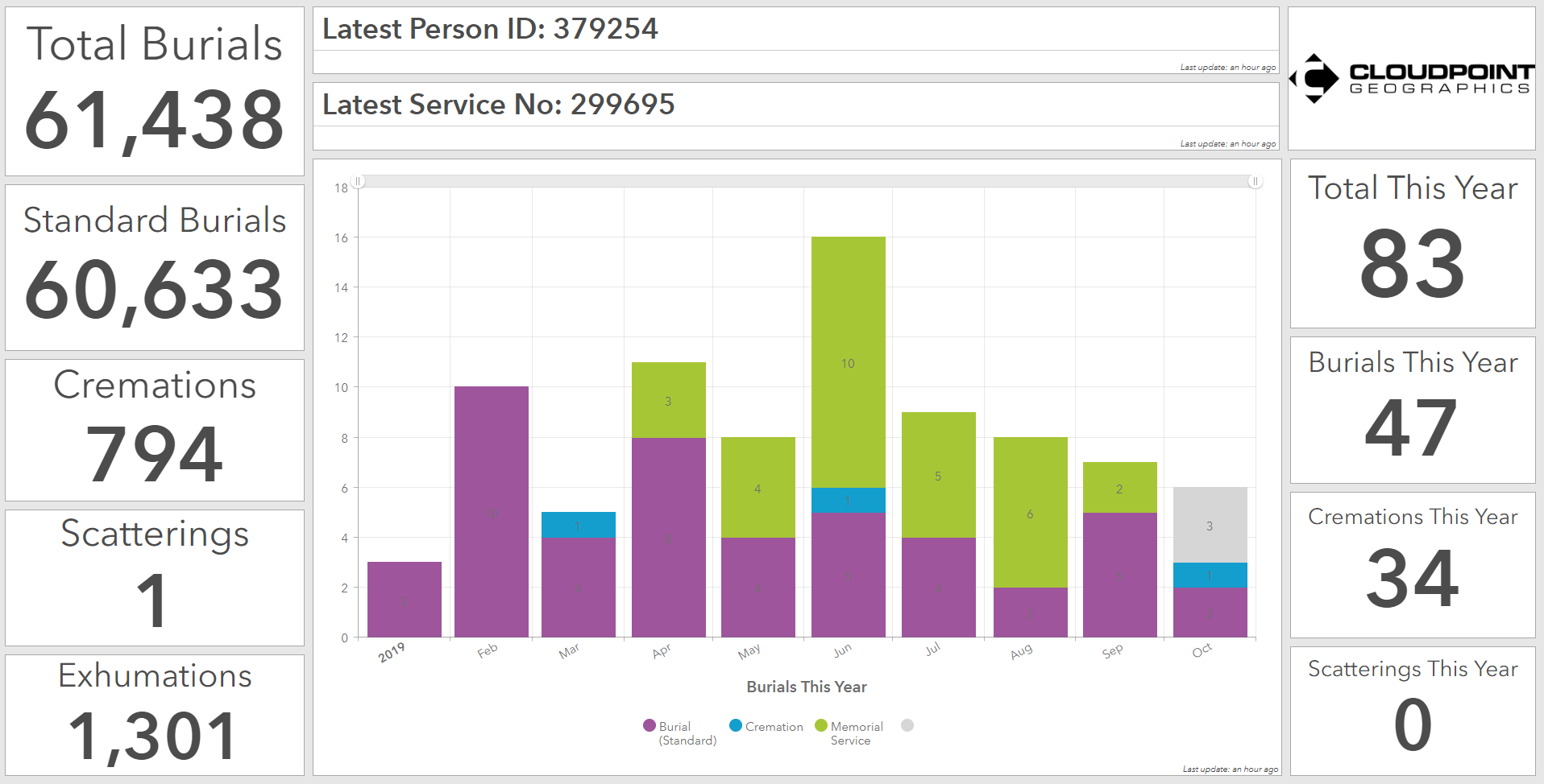
Our dedicated cemetery team has been creating cemetery management solutions for clients for the past eight years and has completed projects for cemeteries ranging from 5,000 to over 70,000 gravesites. We know there is no one-size-fits-all solution for cemeteries, and that’s why we utilize web-based Geographic Information Systems (Web GIS) to configure user-friendly applications that your staff can use to manage the cemetery and the public can use to search for available graves or the final resting place of loved ones.
How YOU Put it to Use:
How WE Put it Together:
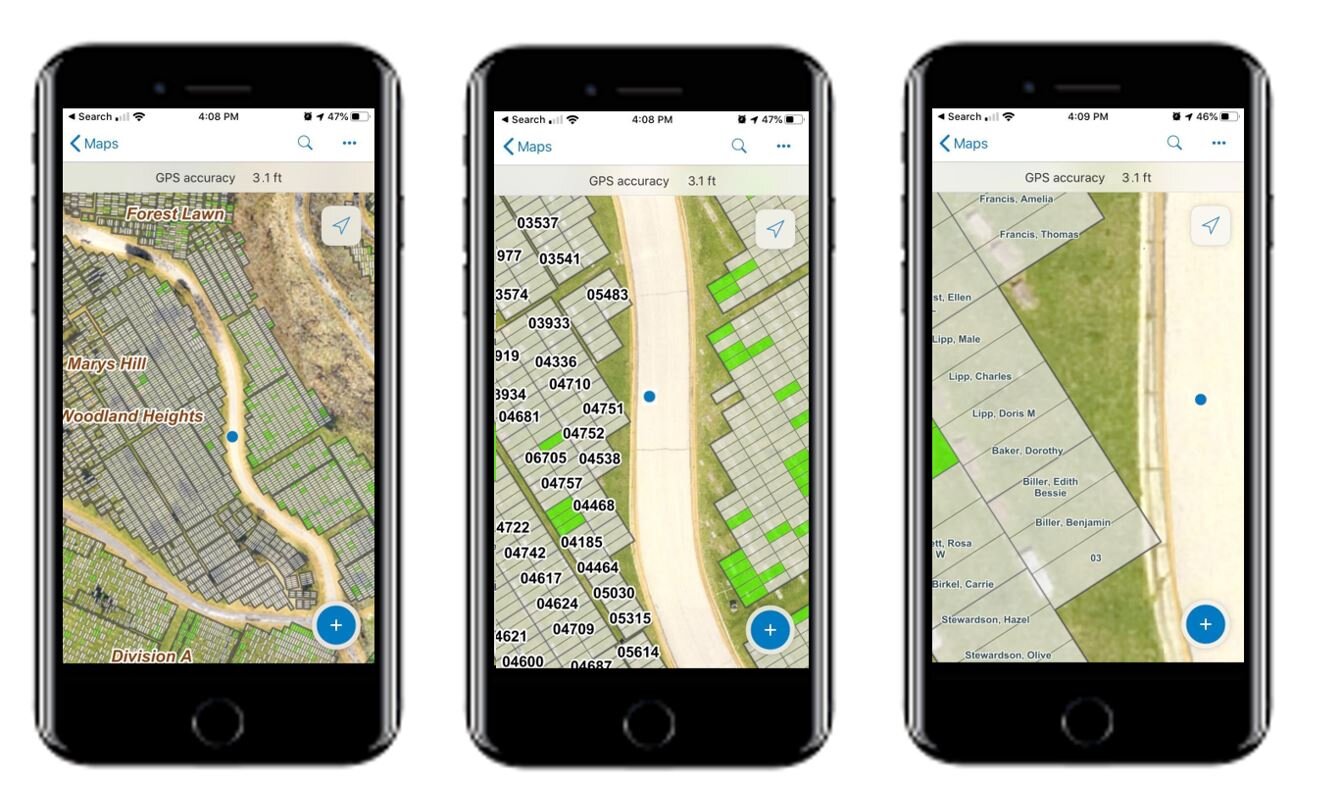
Mobile device integration
Browser-based access to all applications
Attach reference documents
Turn-by-turn routing & navigation
Share pertinent information with the public
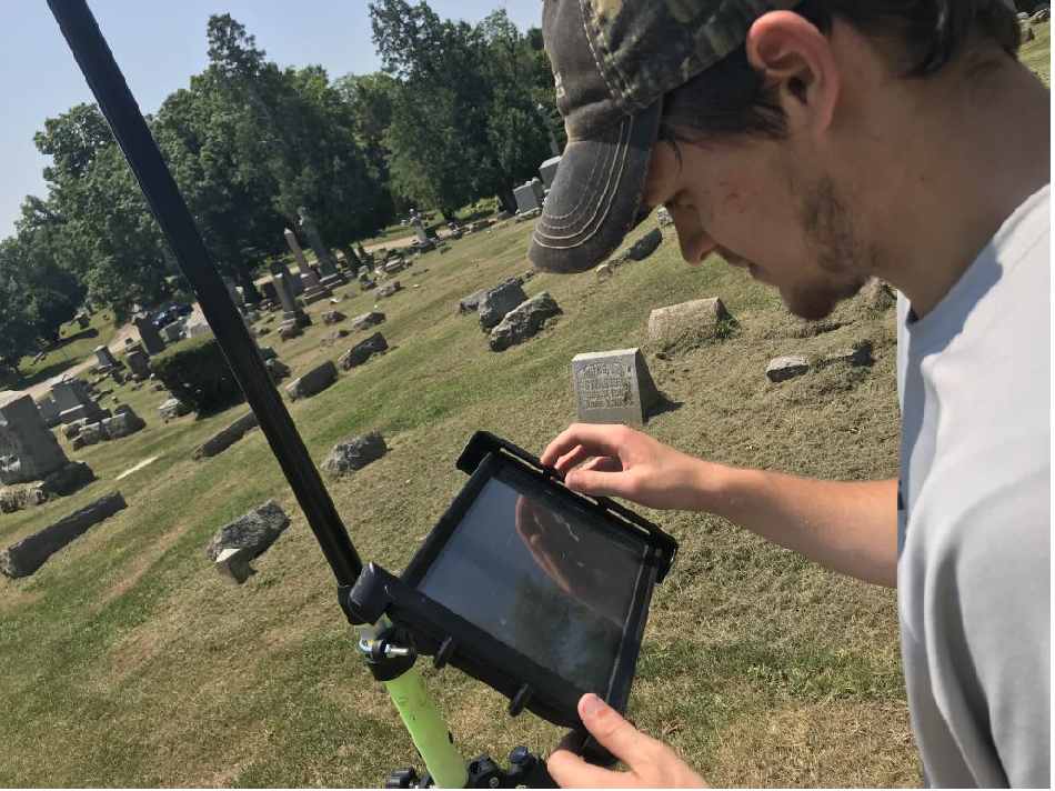
Data Collection with High-Accuracy GPS
Aerial Photos collected with Drone Technology
Digital Conversion of historic records
Conversion of maps (paper and/or CAD)
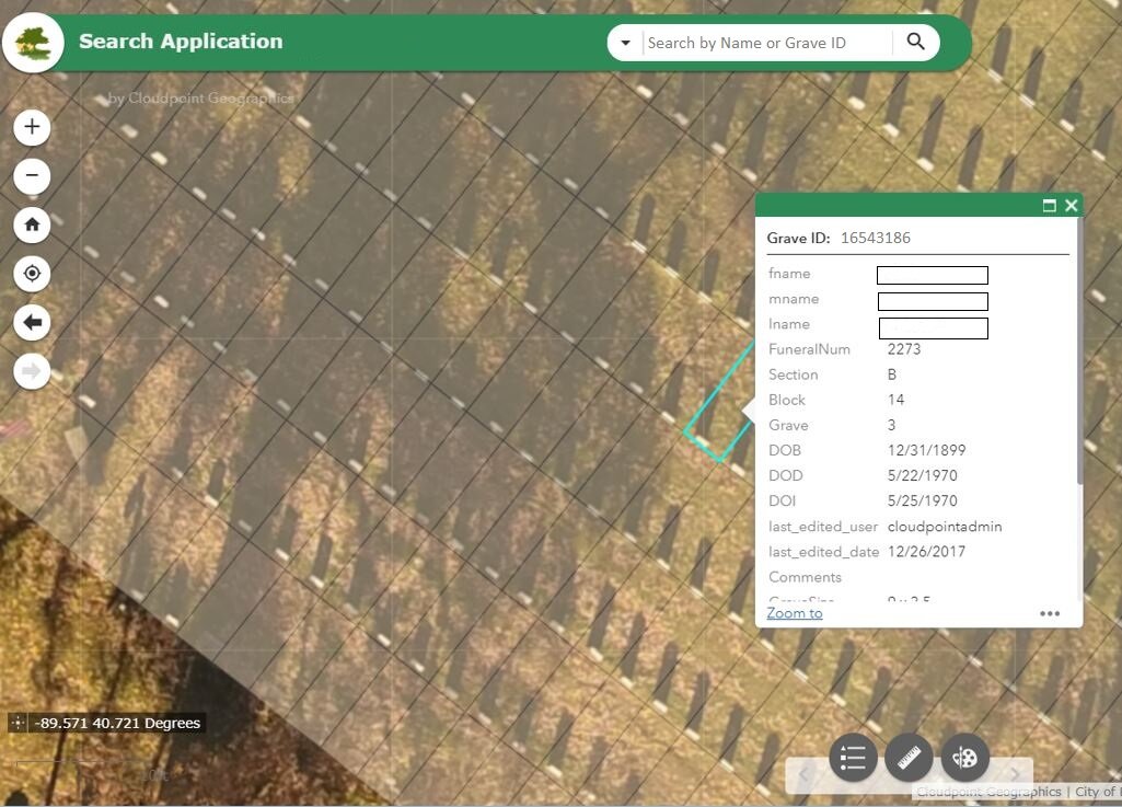
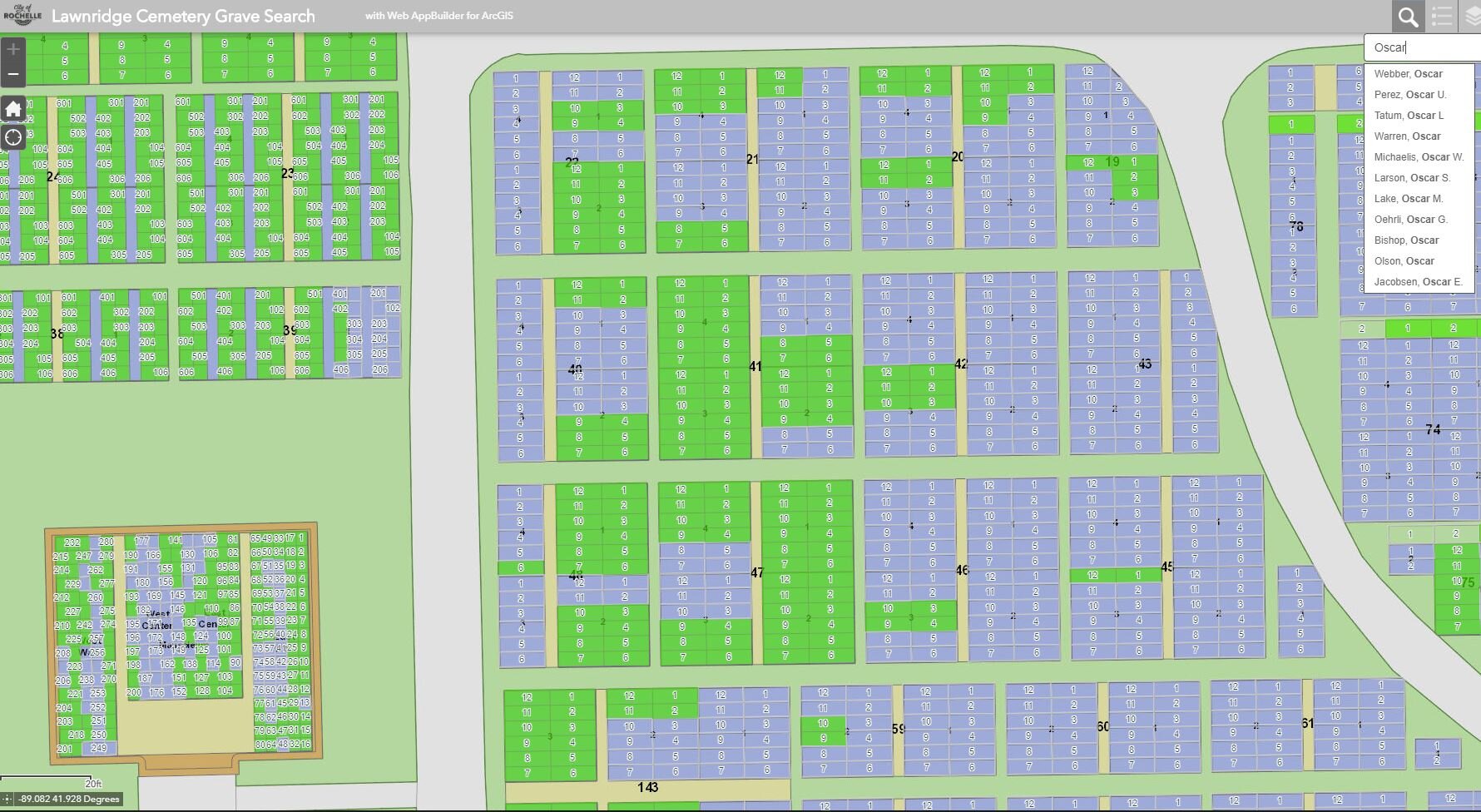
Below are samples of our public search applications. Each application was created to suit the needs, data, and budget of the client.