
Have you ever wondered what drones can do for you? In this post, we will take a look at some ideas on how your organization can save time and money with drone mapping. The hype is over and now drone technology is making its way into today's mainstream technical workflows. Now its time to take a good look at the return on investment to see if it all adds up. Below are few examples of how drones are helping people in their everyday jobs to make them easier and more efficient. More information is available at our site cloudpointgeo.com/drones
Aerial orthoimagery
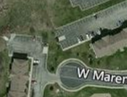
Standard basemap used for online applications makes it difficult to determine objects in the photo which are used for creating GIS features and layers.
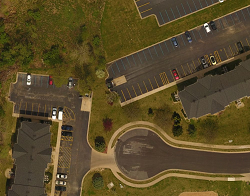
Same area with drone imagery at 2" pixel resolution. Objects such as water valves, sidewalks, and pavement distresses are visable.
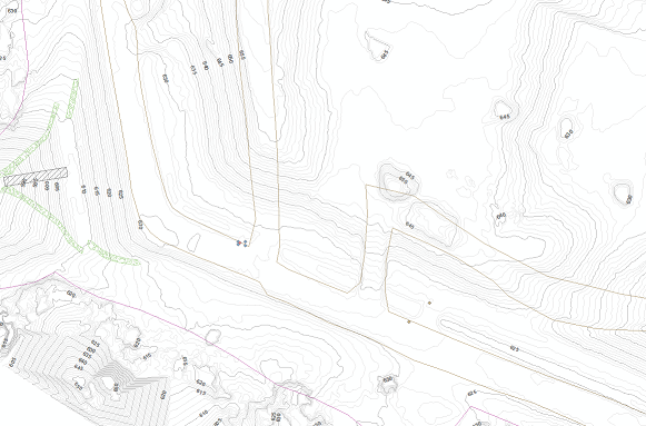
Topographic Data

Screen shot showing 5-foot base contours with 1-foot interval contours derived from the DEM generated from processed drone imagery.
Historic Preservation

The City of Rock Falls wanted to preserve a snap shot of this historic riverfront building prior to its demolition later this summer. Click on the image to explore the 3D model. Left mouse button to rotate or hold shift key to pan.
Digitize GIS Layers

GIS layers can be digitized over the drone imagery for high-accuracy results. Here we see electric and water lines that were drawn in the map on top of the high-resolution imagery. Utility layers can be digitized easily since more features are visible in the photos than typical base maps saving valuable field time and expensive GPS equipment.
Planimetric mapping
Planimetric data derived from drone imagery such as edge of pavement, buildings, paved ditches, and tree lines are shown in this example. Typically this information would need GPS shots and coded values to "connect the dots" from field survey. With drone imagery they can be digitized in AutoCAD Civil3D or Microstation.
Tower / Building inspections
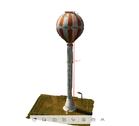
Here is a sample of a water tower model which was used for analyzing paint defects. The Client chose to spot repair these areas instead of repainting the entire tower saving over $400,000 in next year's budget.
Cloudpoint Aerial Services, a subsidiary of Cloudpoint Geographics, provides professional geospatial solutions using drone/UAV technology. The deliverables can include high-resolution aerial imagery, contours, planimetrics, 3D models, digital elevation models, CAD layers, Civil 3D surfaces and more. Being GIS professionals provides a distinct advantage in Cloudpoint's ability to rapidly deploy this data to the web and serve it up as a web map or tiled imagery. Organizations needing quick turn-around on their data can count on a delivery in just a few days or even hours in some cases. See our project portfolio for more project examples. Call us at 877-377-8124 or fill our the form below to learn more.