

The Illinois Statewide 9-1-1 Administrator has released information for FY2025. There is $12 million available for funding GIS projects with a submission deadline of February 20th, 2024. The grant now covers the creation of indoor school (K-12) map data layers, while still supporting projects for required GIS data layers. The state’s prioritization of Indoor school mapping is an exciting development that Cloudpoint fully supports. Cloudpoint has already developed incredible Indoor data for schools and we are ready to assist Illinois PSAPs in vastly improving their school building emergency data.
Customer Spotlight - Monte Johnson, City of Sullivan

Meet Monte Johnson, City Clerk and GIS Administrator for the City of Sullivan!
Mr. Johnson has been with the City of Sullivan for 21 years filling in many different roles and wearing many different hats. He graduated from Illinois State University in 1995 with a degree in Business Education, and has since earned an associate’s degree in Information Technology - Network Administration. He currently severs as the City Clerk and GIS Administrator as well as other roles critical to municipal operations. He began working for the City when he was in high school as a part time lifeguard and swim instructor. His full-time duties began in 1997 when he was hired as the Assistant Director at the Civic Center. He created the City's first website in 2002 and has been serving as the City's webmaster since. He began building the City's GIS system in 2007 and has turned that into a City-wide system with remote access through web-based applications. He began redesigning the City's digital document system in 2012, and it now has a public portal for the public to access documents, allows departments to remotely access documents, has workflows to automate business processes, and has an online forms portal for the automatic submission and handling of web-based forms. He was named the City's Freedom of Information Act Officer and Open Meetings Act Designee in 2013, and the ADA Coordinator in 2017. Through training and education, he was conferred the title of Registered Municipal Clerk by the Municipal Clerks of Illinois.
The City of Sullivan owns Electric, Water, and Gas utilities and contracted with Cloudpoint beginning in 2014 to implement an enterprise GIS system by collecting GPS data, centralizing database records, and securing an Enterprise License Agreement from Esri which opened the door for providing location-based decision making for each department. All departments now have iPads helping them access and update their information in the field in near real time. They also have many web apps available for departments (and the public) to see all of our utility information as well as general public information (Zoning, TIF, etc).
As City Clerk, Mr. Johnson’s responsibilities include preparing agendas and minutes for Council meetings; keeping up with, informing the Council about, and enforcing new municipal laws; preparing and publishing legal notices; handling bidding requirements and documents; handling and coordinating annexations and zoning; tax location verifications; coordinating building inspection and permit reports; assisting the City Attorney with research and paperwork; assisting with and acting as a liaison with engineering firms; IT support for all City departments; administrative support for all City departments and the City Council, including research for health insurance renewals, lawsuits, collective bargaining negotiations, updates to the employee handbook, research for software and technology, updates to policies and procedures; handling of all licenses (liquor, raffle, A frame signs, carnival, golf cart, merchandise on public streets/sidewalks, outdoor dining, peddler's, rubbish, food vendors, waste disposal), and serving as the City's Open Meetings Act Designee. One of the greatest benefits Monte has recognized from the use of GIS is that city staff no longer has to look up paper documents and maps. Everything is there at their fingertips in digital format. Mr. Johnson has a gift for administration and technology and he looks forward to continuing to expand in the City’s use of GIS technology and helping them informed data-driven decision in the most efficient manner. The Cloudpoint team is privileged to have the opportunity to work with him and the City of Sullivan.
Customer Spotlight - Scott County, Iowa
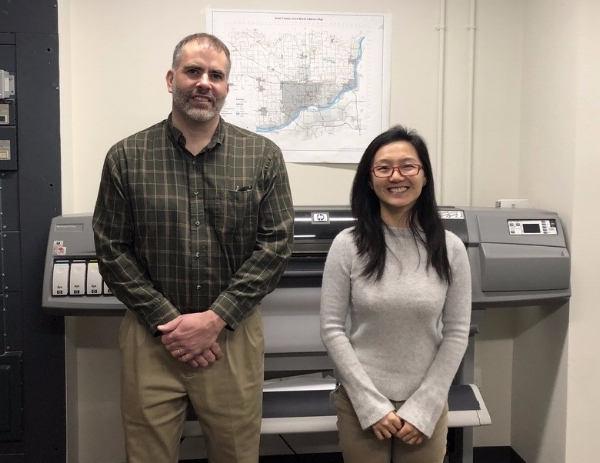
Meet Ray Weiser (left) and Sunny Shang (right) of the Scott County, Iowa GIS Department!
Ray has been with Scott County longer than he can remember, but not long enough to retire. Before that he worked at Shive-Hattery and Bi-State Regional Planning Commission just across the river. Sunny has been with the County for just over 3 years. Prior to that, she completed her masters degree in Geography at the University of Iowa.
Ray manages all aspects of the county GIS, and Sunny provides backup while also focusing on department support and web programming. The County has two ArcGIS server installations and a multi-versioned parcel database that replicates weekly into a publishing geodatabase. They support innumerable public users of the GIS websites which pull layers and data from both ArcGIS Online and an ArcGIS Server instance on Amazon Web Services. Sunny recently built a web-based Integrated Roadside Vegetation Management (IRVM) application which tracks native and invasive species along County roads. The two help the Conservation Department maintain maps & layers of the county’s recreation areas, assist the Health Department to determine at-risk parcels for lead contamination, guide County Assessors to recent permit locations, delineate watersheds and erosion in County ditches for the secondary roads department, and support emergency first responders & computer aided dispatch operations for the Scott Emergency Communications Center.

Here you can see some of the maps that Ray and Sunny have compiled for Scott County.
Since Ray and Sunny are the only two full-time GIS personnel in the IT department, they are constantly using the technology to solve problems for other County departments. The best method of isolating issues for County departments is a simple conversation with County staff. A recent Check-Up from Cloudpoint has helped analyze these relationships and created an opportunity for additional outreach and support actions.
The technology is always changing and updating. Ray and Sunny are involved in several regional GIS user groups and have attended large Esri conferences in the past. It’s difficult keeping up with all of the templates, data models and applications available from Esri but, with some help, this dynamic duo is looking forward to a bright future of GIS with Scott County leading the Quad-City region in GIS and the geospatial field!
Thanks for sharing your experience Ray and Sunny, and thanks for allowing Cloudpoint to assist Scott County in reaching its goals!
Customer Spotlight - Tim Isley, Streets and Cemetery Superintendent, Rochelle, IL

Tim has been with the City of Rochelle Street Department for 14 years. He started out as an operator in 2003 and in 2013 he became the Streets and Cemetery Superintendent.
As Superintendent, Tim’s responsibilities include: maintenance and repair of all city streets, alleys, sidewalks, and parking lots; inspection, repair, and replacement of the city storm water system; maintaining all traffic control devices to MUTCD standards; managing the city forestry program; snow and ice control; and managing the city owned cemetery.
A typical day for Tim at the street department starts out with using GIS. Staff will grab an iPad and hit the streets to complete Julie locates to protect the storm water system. The entire storm water system including sizes, materials, and depths have been entered into GIS and by doing so, have made this daily activity much more efficient. They also use GIS to help manage the traffic sign operation. Every traffic sign on the shelf and in use in the field has been, or is in the process of being, barcoded and entered into the SignOps system to manage the City's sign inventory, ensure all signs are up to date, and MUTCD compliant. Another area they have just brought GIS into is the forestry program. Toward the end of last year, Tim and his staff started using GIS to map out and inventory all city parkway and other city owned trees. They are tracking tree location, species, size, condition, and potential hazards, just to name a name a few.
"GIS has become a vital part of our operation and because of all the benefits it provides, I see it growing into many different areas. We started using GIS about 4 years ago and now we use it on daily basis to help manage our storm water system, traffic sign operation, and forestry program. Because of the accuracy and efficiency gained in these three areas we have decided in 2017 to expand the use of GIS into our cemetery operations as well."
Thanks for the kind words Tim and thanks for allowing Cloudpoint to assist the City of Rochelle in reaching its goals!
Customer Spotlight - Janna Baker, GIS Coordinator, Tazewell County, IL

Janna Baker, Tazewell County GIS Coordinator, is a great proponent of applying GIS at the county government level.
Janna Baker is the GIS Coordinator for Tazewell County, Illinois. Here is a little bit of information about Janna, how she got to where she is today, and what GIS has done for her.
Janna has been with Tazewell County for over 2 years. She was an intern with the County from April to November of 2014, and then took over as the GIS Coordinator.
As part of her duties, Janna is responsible for administering GIS databases through SQL Server software and ESRI software, managing GIS websites/services hosted on-site, creating new GIS websites/services, handling map/data sales, distributing map services and policy development, troubleshooting hardware/software issues, and identifying data needs, quality, accuracy, and standards,
When asked how her and her staff currently use GIS on a daily basis, Janna says, “GIS is used to increase efficiency in managing spatial data and serving it to the public. An example being parcel data in the Assessor's Office. GIS allows for quick access to parcel information by both staff and the public. Web access to the parcel data reduces the number of public calls to the Assessor's Office, freeing staff for other work. GIS provides staff with the ability to visually identify errors with ease and to correct them quickly. Through the enterprise database platform, these corrections can be immediately served out to GIS users in other departments, like Zoning, who rely on the parcel data to aid in their decision making, and to the public through GIS Web Maps.
Janna knows that GIS will play a large role for Tazewell County moving forward. She emphasized that by saying, “GIS is a very effective method of relaying information both between government entities and to the public. The ability to display tabular data as a model of the real world, and to visually display analysis of that data, is a benefit to government decision making in all areas. GIS will continue to integrate into more departments as it provides a fast, centralized way to manage and share spatial data, both internally throughout the organization and externally to the public."
Cloudpoint would like to thank Janna for her commitment to GIS technology and use of the Esri platform in helping her organization to succeed with providing detailed geographic data to the citizens of Tazewell County. Because of Janna’s insight, the County is tracking their information and infrastructure like never before, allowing them to build upon her work for years to come.