Joe Christian joined the Cloudpoint team at the beginning of April. The first day, Joe showed up in business dress but with a backpack of clothes for field work. He said, "I didn't know what to expect, so I wanted to be ready". Great job Joe! passed on-the-job test #1. Joe is a former employee of LT Environmental in Colorado and the City of Bloomington (IL) Engineering Department. Many people might also recognize him from his dugout dancing days working for the Peoria Chiefs organization or being lead guitarist/singer in local band "The Kritters". Joe graduated in 2014 with a degree from ISU in Geography, as well 2008 from Western Illinois. We're excited to have Joe's energy and talents to work for us. He will be quite useful in the field tagging traffic signs as well in the office kicking out the map projects, however we don't have any dugouts to dance on.
esri partner conference
As I woke up this morning to 5 degree weather in central Illinois, I could help but think of poor Micah who is on his way to the esri partner conference in sunny Southern Cal where tomorrow's high will be a measly 82 degrees. No, those of us holding down the fort here in the frozen tundra are not bitter in the least.
Disclaimer: This is only a representation of a truly accurate golf stance and by no means is intended to portray Micah's swing....
This is the second year in a row that Cloudpoint has had opportunity to attend this conference and we are thankful for a strong partnership with esri as a leading provider of GIS services in our area looking forward to a continued relationship for years to come. In the meantime, hopefully Mr. Williamson will return with more than a sun tan and improved golf game. #EsriEPC
Catchin up with old friends at the 101st T.H.E.
We were able to sponsor and exhibit at the T.H.E. conference this week at the historic Illini Union building on the campus of the University of Illinois at Urbana-Champaign. This conference congregates transportation professionals from all areas including city & county engineers, highway officials, consultants, technicians, faculty and students who gather to discuss issues critical to the safe and economical movement of people and goods across Illinois and beyond. It was well attended with almost 1,000 people registered. Jon and Brett Hodel attended to help promote our GIS/Asset Management services and sign inventory management system called SignOps. @THEatIllinois
CLOUDPOINT GEOGRAPHICS TAKES TO THE SKIES
Cloudpoint Geographics forms strategic partnership with Kovar & Associates, LLC to offer aerial mapping services using drones
Roanoke, IL, February 15, 2015– Cloudpoint Geographics is pleased to announce a partnership with Kovar & Associates LLC to offer professional aerial mapping services with UAV's (drones). Mr. Kovar is a licensed fixed wing and rotorcraft pilot and specialized cyber-security consultant. He has been involved in disaster response and search and rescue for over 15 years and has a passionate interest in mapping and imagery due to this experience.
“This strategic partnership positions us for an early entrance into a brand new market that will dramatically expand our geospatial offerings throughout the state of Illinois and the Midwest region.” says Cloudpoint president, Jonathan Hodel
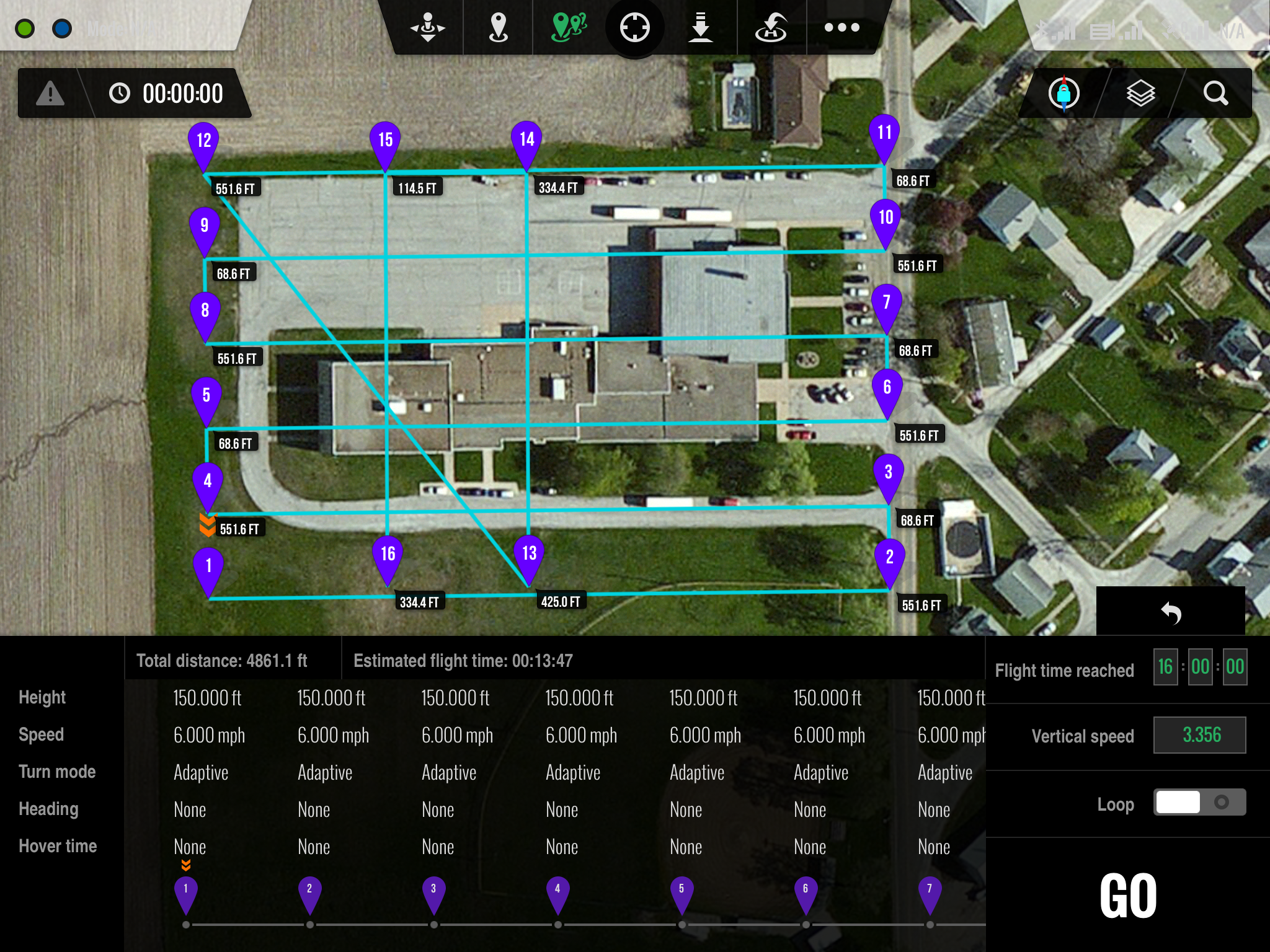
Ground Station iPad interface
The Cloudpoint / Kovar team has submitted a request for an exemption with the FAA to allow for commercial drone operation for aerial mapping. The approval process is anticipated to take several months however these firms are committed to establishing a safe and effective program for using this technology. The FAA is currently in the process of developing regulations for commercial use of drones in many different applications.
Cloudpoint is a dynamic geospatial solutions consulting firm providing mapping and GIS services for a variety of clients.
Parcel Fabric for Las Cruces New Mexico
Las Cruces, New Mexico: Cloudpoint is excited to begin a parcel fabric migration for the city of Las Cruces. The Parcel Fabric is a part of the Esri Local Government Information Model and quickly becoming the industry standard for parcel maintenance. Using the parcel editing tools that come with Esri ArcGIS desktop (No costly 3rd party extensions) Cloudpoint will remotely perform the migration quickly and efficiently. Las Cruces GIS staff will have a product that includes parcel history, is easier to maintain and more spatially accurate. Cloudpoint is able to compete for jobs like these on a national level because of our mobile connectivity and nimble ability to understand the problem then propose a great solution.


