
More appropriately; two years of GPS points from a middle-aged white guy trying to be a runner.
Earlier in my life, I never ran. I mean from bears, sure, probably I would have. I occasionally played a round-ball-type sport that required moving arms or legs quickly. If I had to actually run, I hated every second and would never consider running for health. Well, circumstances change and different things matter as you approach mid-life. Two years ago I found myself weighing a lot less and being challenged by a (very fit) cousin to take up running to maintain. He bought me a Garmin watch and so began the long transformation into a runner. There are many articles to get you started here is a great one that outlines the health benefits as well as a few tips for beginers.
The Watch.
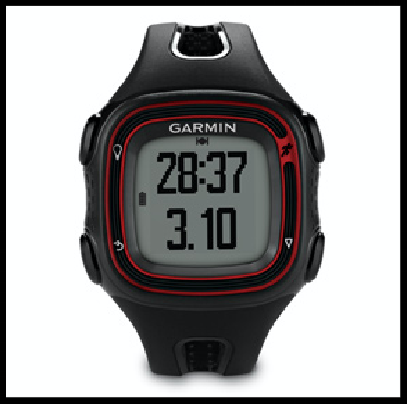
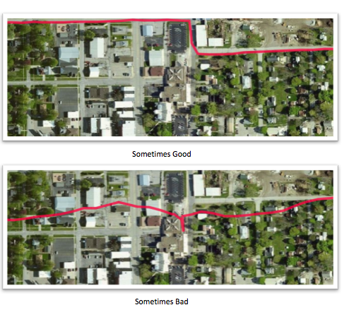
The Garmin Forerunner 10 is the most cost effective GPS watch that Garmin makes (or did). It tracks decently (See image for accuracy) and has been a faithful companion across the country. If I'm in a new area or the battery is low, acquiring satellites can take a few minutes. The interface is easy but barely adequate. I wish it would record my heart rate or even show me a compass. I'm not just going to buy a new watch without actually needing one but the Garmin vívoactive HR is on my shortlist.
The Data.
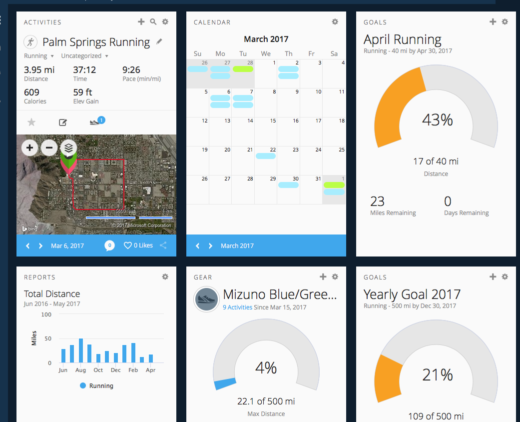
This is a sticky situation. I, along with lots of other people, don't like the way Garmin keeps data captive. Their Connect interface is great, there are goals to set, an interactive map to trace your run and you can export your runs to a gpx... but only ONE AT A TIME. That seems ridiculously inefficient. I'm not even that active of a runner and it would mean hundreds of GPX exports over a 2 year period. There are many services that try to interact with your watch & Garmin account. Tapiriik, Strava and Endomodo to name a few. The idea is when you sync your watch, the service sees that addition to Garmin Connect and syncs with another, more open, platform. I like the goals, maps & equipment tracking of the Garmin system. I just also like my data to be my data.
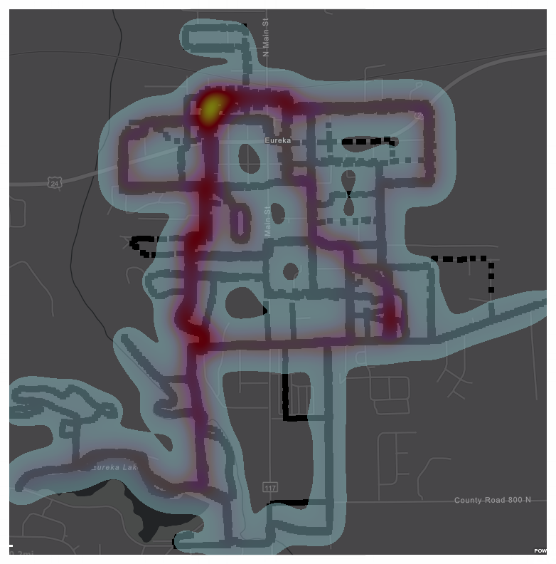
The Map.
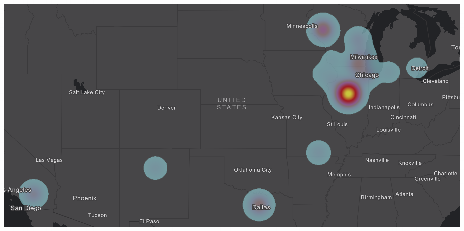
After a several iterations of various undocumented work-arounds (one of which involves knowing and running a Python script) I was able to pull my data out of Garmin Connect and into a merged feature class. This point file was subsequently uploaded to ArcGIS Online for some smart mapping, analysis and possibly a story map. The reason for a point file is simply due to the GPX output that Garmin gives up. I could have converted it into line features but the first round didn't look as nice as points did. Initially I did what you do with point files, HEATMAP! The results are cool, but not surprising, I live in Eureka, Illinois.You can probably pick out my favorite loops around town. Below is a web map application of ALL the data.
The map takes a bit to draw there's 49,000+ points spread out over 200 runs. I did run in all of those places. It kind of became a obsession as I traveled around, making sure I brought along my shoes & shorts, planning out where I could go. It was fun and just the beginning.
Zoom In a bit to see the routes to Link Here to see the big map.
Let me know if you have any Questions.