

Even though we have all become more technically adept, the idea of customized programming is still out of reach for most users. However, that does not stop us from wanting the shiny buttons and slick applications. Enter COTS software. This very blog is written on COTS software. Long gone are the days when a solid grasp of HTML and CSS are needed for a great website. Squarespace, Wix, Google Sites along with probably a dozen other site builders exist to enable YOU to create your own slick website for your company, organization or department.
Cloudpoint From Home

We are all working though these confusing and trying times to find a new normal. There is a plethora of advice for not going crazy and a few tips from other GIS Professionals. I thought I’d share how Cloudpoint Geographics has managed and migrated to a distributed workforce while continuing production on essential projects and even expanding..
Get some REST!

With the GIS industry acceptance of ArcGIS Enterprise and Online (whether you like it or not) as a location for data sharing and display. We at Cloudpoint Geographics regularly grab REST endpoint of important services that are publicly facing and put them on out internal websites. As well we have an ongoing collection of ArcGIS Online Organizations homepages an Open Data sites as we come across them.
ArcGIS Enterprise on AWS

Have you seen all those clever and funny AWS commercials? For the normal GIS person adding yet another platform to learn and use can be a bit daunting. Don’t fret, we are not abandoning you, to put your mind at ease yes, we can handle that for you BUT for those of you who are D.I.Y. Geogeeks; below are some tips.
Shadow IT & Shadow GIS

There are two meanings here: 1. You might be building your GIS as Shadow IT, know the pitfalls and realities. 2. Beware your GIS 'clients' may be building Shadow GIS underneath you.
Shadow IT is a real thing. It's talked about at conferences and even has a Wikipedia page. Essentially, it is when 'unofficial' tech infrastructure is built in parallel to the official IT department; sometimes sanctioned, sometimes not. GIS could exist as a Shadow IT in both positive and negative way
1,874 Mile Road Trip Tools

Last Week, I (Micah) drove Paul's Ford Focus out to Carson City, Nevada while he drove his Ranger truck and Smoky the Cat. This was an easy drive, directionally speaking. Interstate 80 goes all the way to Reno Nevada just 15 miles north of Carson City. It's 1,874 miles from Peoria to Carson City. (Aside from audio books, podcasts & windshield mounts) There are several maps apps & websites I used to help plan and document our 3-day journey
Co-Dependent GIS? call 'The Cleaner'
Are you stuck in a bad relationship ... with your GIS? You need help, you need out. Call the Cleaner. In all seriousness, time and time again, our professional services team has encountered potential clients that are just stuck using some antiquated version of ArcGIS or burdened by some legacy vendor because "That's the way we've always done it"
Mapping of a runner.

Earlier in my life, I never ran. I mean from bears, sure, probably I would have. I occasionally played a round-ball-type sport that required moving arms or legs quickly. If I had to actually run, I hated every second and would never consider running for health. Well, circumstances change and different things matter as you approach mid-life. Two years ago I found...
OpenFields ArcMap Add-on.

Farmland Assessment Tool for GIS users.
We have developed a simple ArcMap (soon to be for ArcGIS Online & Pro) add on that will assist parcel managers with Farmland Assessment specifically in Illinois. And we're giving it away for free.
Removing Roadblocks
The State requires and overlay of three separate layers for proper valuation and assessment: Parcels, Soils and Land Use. It's a rather simple geoprocessing function of these layers that results in the required acreage calculation of each parcel polygon to be properly assessed
Mapping the Best Places to Work.

Sometime ago I read an article on the Forbes Magazine website about a yearly index they create that was screaming for a map. Every year demographers at Forbes comb through US Bureau of Labor Statistics data and the rate 'Best' small, medium and large US cities for job growth. As I read the article I kept wondering, "Where are these in relation to one another?" and "Is there a certain concentration geographically as a whole?" So I got my hands on the dataset...
The more things change, the more they stay the same

I have installed production ArcGIS Server systems over a dozen times (rough estimate not counting upgrades) at different locations and under different IT environments. It is a world of change from the old ArcIMS days and so much easier. No Apache Server, no Tomcat, no enabling user permissions to make changes to the environmental variables or setting the %JAVA_HOME variable (How many times did a Java update break our sites? Ugh!). That being said each install has its own idiosyncrasies and challenges...
All of Illinois Geocaches in One Map*

I work for a living, but in the off times I still play with this technology, so I have a Premium Geocaching subscription. This allows me to query their data in circular buffers and return a GPX file. After about 27 of these queries, I was confident that I had all of the cache locations I wanted. Running a few geoprocessing functions, I dropped any duplicates and union-ed these points to county polygons to get the number within each county. This data are reflected in the Classified inset map. What am I talking about? Geocaching of course. If you're reading this tech blog there's a pretty good chance you already know what geocaching is...
Zoom to your Room.
ArcGIS Online has released a new update for November.
Here is a list of what was expected.
Among them is a hidden gem that hardly got noticed or mentioned but will change the way we do GIS on the Collector App.
World Imagery, World Street Map, and World Topographic Map will be updated with additional levels of detail in the tiling scheme to support display of larger scale data in or on the basemap.
Did you see it? No neither did anyone at our office. That was until Paul stumbled upon it while using Collector this week during a data collection project. He kept zooming in and zooming in until all the valves were individually visible.
If you have never come across this, it's a BIG stumbling block for utility folks! Lots of these guys have oversized hands and clicking on a bunch of tiny dots can really get frustrating.

This is the difference from an ArcGIS Server Cache to the Esri imagery Basemap
In the past we have created a tile caches down to 1:500 for ArcGIS online (Or 1:250 if they have ArcGIS Server) this allows our clients to zoom in close enough to see the different features. Possibly click on several and hope the one they want got selected.
No More!
Esri updated Three Basemaps (4 if you count Labels) World Imagery, World Street Map, and World Topographic Map that now zoom-in to an unbelievable 1:71 !!! I cannot overstate how awesome this IS. Sure the imagery and maps are a little fuzzy but WHO-CARES at that scale you just want to be able to see the features separately.

If you look into this on ArcGIS Online web map, you can see that it's actually called "Room Level"
**Note if you Don't see this change on the Webmap interface, SAVE your map and try opening it again. AGO is a SAAS, but still needs to update the capabilities of the Webmap.
Now, get out there you large-handed-gorilla & Zoom-Zoom!
All Moved In (Guest Writer)
Below you'll find an article in our local paper from Journalist Cheryl Wolfe of the Pantagraph papers in Bloomington, Illinois. She did a fantastic job and we wanted to include her article in our blog as a "Thanks!".
(Reprinted with Permission)
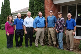
ALL MOVED IN--Employees at Cloudpoint Geographic, Inc. are: (left to right) Jodi Hoffman, Paul Stephenson, Micah Williamson, Joe Christian, Matt Junker, Tyler Severson, and Jonathan Hodel
Cloudpoint Geographics moves to new office
Hodel plans open house
CHERYL WOLFE
cwolfe@mtco.com
ROANOKE—These days, Jon Hodel often has his head in the clouds and is always thinking higher.
When office space for his growing business, Cloudpoint Geographics, Inc. got too small, Hodel started looking for something bigger. He found it, just a block away in the building that formerly housed Dr. Michael Meier’s dental office.
A building with several smaller rooms might not fit the needs of most businesses, but for Hodel and his employees, it was literally a godsend.
“This office has been a perfect fit for us,” Hodel said of the building. “The Lord provided for us; we couldn’t have asked for a better fit.”
Hodel said it was getting crowded in his old office on Main Street, but now all employees have their own space, in addition to a conference room and a kitchenette. And, the move kept Hodel’s business in his hometown, just where he wants it to be. There was a time when Hodel was thinking of re-locating to another town because he could not get enough high speed Internet service in Roanoke, a service that is vital to his business. But he recently found a way to get by with the service in place.
“We don’t have fiber yet due to the cost, but we’re using the Amazon cloud, and we’re getting by for now,” Hodel said. “We have seen increased efficiency, and cost savings came into play.”
Most people don’t really understand the kind of work Hodel does unless they are very technologically savvy. Hodel is a licensed professional engineer and certified Geographic Information System (GIS) professional. His business started with him, by himself in an office with a laptop, and grew to where it is today with one part-time and five full-time employees. Their work includes GIS mapping for government utilities and public works and asset management, among other projects. Simply put, they make maps, Hodel said. But the maps are not simple.
GIS maps are detailed and made using satellite technology. They allow clients to visualize, question, analyze and interpret data to better understand patterns and trends, as well as what is happening in geographic space. They are also valuable in creating and maintaining more accurate records.
There is a growing interest and awareness of the economic value of GIS. It can be used to manage assets, such as the life expectancy of streetlights or to schedule garbage truck routes to maximize efficiency in fuel and labor. Cloudpoint performs both small jobs and big ones, like a utility mapping job in Mendota that has taken all summer.
These descriptions are only a fraction of the work that Cloudpoint is capable of doing, and they barely scratch the surface of what will be available in the future. Hodel said drones will be used as a powerful commercial tool in the future pinpointing a number of things, from agriculture applications to other commercial uses. He plans to be a part of that technology as it is implemented.
”We’re really excited about the new technology drones will bring,” Hodel said. “It’s fascinating. I really enjoy new things. It’s the engineer coming out in me.”
Hodel said he hopes to hire a licensed pilot to work with drones in the future to create another arm of his business.
The work of Cloudpoint Geographics is far above most of the public’s head, so getting his name out and helping others learn about the services he provides to gain new business is sometimes challenging.
“We find we do a lot of door knocking, and use our web presence,” Hodel said. “Most of our business comes from referrals or face-to-face marketing.”
Hodel wants to do a little face-to-face marketing with the people of Roanoke where he has lived most of his life. He has invited them to come see his new office during an Open House, on Friday, Oct. 2, from 4-6 p.m. He will be glad to explain some of the fascinating aspects of his work to anyone who is interested. And, he wants everyone to know how much he enjoys his new office in Roanoke.
“We’re really happy to be here,” Hodel said.
DC by Map.
Two weeks ago we loaded up the family truckster and headed out on a 10 day 9 night camping vacation. No worries: we're campers, it's not a big deal to myself, my wife or my four kids to plan and enjoy 7 days sleeping in a tent.
What's different about this trip was the "urban-ness" of the campground. Greenbelt Park is a nice enough campground. The sites were fairly level, bathrooms tolerable, (see my Yelp review) water was cold and accessible. That's all an aside, what is important now is what I used to navigate from Greenbelt Park to downtown Washington DC and back and getting around while we were down there. Yes we planned on driving downtown, taking the Metro downtown from Greenbelt roundtrip for 6 people was $48.
For a few days I banged my head against the marble walls using Apple Maps and BestParking apps. too frustrating.
This was not a 'no tech' vacation. A flatlander in Washington DC trying to keep track of 4 younglings while searching for the best parking space or photogenic angle of any one of a dozen different memorials NEEDS a smartphone.
Navigation:

My Daughter figured out the interactive map in about 4 seconds. (pretty sure it's operations dashboard)
My first premonition should have been the LTE. Verizon LTE was spotty, Oh I had coverage, it just seemed to be bogged down. Lots of apps wouldn't work without LTE. Apple maps was one of them. Google Maps? Flawless on 3G. I should have switched then. Also Apple maps insisted that I make a U-turn about every other block, (without missing a turn). Their options are so limited it make me wish for my Garmin eTrex. You don't notice it when you are cruising around highways of Illinois or I-80, but in downtown DC in the height of bumper-to-bumper rush hour traffic, I cannot make a u-turn. Eventually for general navigation I chose Google maps over Apple maps & Waze. The 3-D view of Washington in Apple Maps was cool, but I still say 3D is not practical.
Parking:
The BestParking app never actually pointed me in the right direction, it puts a pin on the general side of the block. want directions? That's an in-app purchase. Also they seemed to advertise specials, or prices for hybrids or some such thing not daily or hourly prices. After a few stressful searches, I ended up using 'ParkMobile', an app advertised on DC's own parking meters. I could even "feed the meter" from the app*. Also just biting the bullet and paying for a parking garage helped too. To find the garage again, I usually marked the location with a star on my Google map app. Simplicity. Did I mention how bad traffic was?
Overall Needed DC apps

The National Park Service has a GREAT app that's a simple map with pins on it It's called 'National Mall'. I used that map several times each day, it was a life saver and a must-have for tourists. It has locations of main attractions as well as public bathrooms. Note: the National Aquarium has not been around for several years, but it's still on the map. Also on the one day that we took the Metro downtown the best app was the simplest. 'Metro Map' showed your location and the locations of the trains. That's all it did. No planner, no purchase of tickets just a simple map. Done. After that use logic and common sense. Of course when we did splurge and eat out, I used Yelp to find appropriately priced eateries for a family of 6. I also purchased the National Zoo app for $1.99 but that was mostly for Family Share so that my daughters could see the webcam of the Giant Panda cubs.
Lessons Learned.
The simpler the app the better. The Time & Navigation Exhibit in the Air & Space Museum was the best, but the t-shirt is $38. Parking on the street changes at rush hour. It's 2 miles from Lincoln to the Capital. The Potomac is kinda smelly. You can get soft-serve ice cream and $1 bottle waters from street vendors. The Archives charges twice as much for their copies of the Constitution as the Smithsonians. Parking tickets in DC are $100. Security guards in the Capital do not smile. Aaron Shock's office is still red. View from the steps of Lincoln is awesome. Meet Larry the volunteer at the National Zoo.

To Portal? or not to Portal?
Last year Esri released Portal with ArcGIS Server as a free extension. There has been a fair amount of confusion surrounding the product. What is it? Should we install it? What is it?
One things is for sure; Esri keeps talking about Portal (or at least "a portal") so it must be important, right? Part of the confusion comes with issues of terminology. Another is people being unwilling or unable to explain the difference or what clients should do. I want to help with both.
If you're a Esri shop, ArcGIS Online (AGO) is the platform through which all your GIS will be pushed out to your customers and users. If it isn't now it will be, so go ahead and relent. That platform is a portal (lowercase 'P'). To induce this platform acceptance, Esri decided to giveaway the server-software that runs ArcGIS Online. That is ArcGIS Portal (Capital 'P'). So you're using a portal when you are using ArcGIS Online and you're using a portal when you are using ArcGIS Portal. Get it?
Now, Should you install and use ArcGIS Server Portal Extension? Probably not. Just use ArcGIS Online. Here's a quick Frequently Asked Questions when is comes to campaign ArcGIS Online (AGO) v. ArcGIS Portal (Portal)
Q: What about credits? STOP WHINING ABOUT CREDITS, THEY'RE CHEAP!
Q: What about Security? AGO is highly secure by default, probably more secure than your ArcGIS Server installation, which has No security by default BTW.
Q: Will AGO work with local services running behind my firewall? Yup.
Q: I don't like my data being hosted on AGO. So don't. the idea of a portal is a window, not a dropbox.
Q: Do I have complete control over my content? Yup.
Q: Can the Portal software run on my existing ArcGIS Server? Maybe, but it shouldn't. Are you asking to overload Your PrintServer/FileServer and make it an ArcGIS server too? Recommended Best Practice is to run it on a separate server by itself.
Q: Will AGO Work without the internet? Ok. Got me there, No. Your users do have to have access to the internet and most subdomains on arcgis.com. So you will have to whitelist a fair number of URLs. Whereas portal can completely be on your internal network. Sequestered.
Q: If I'm offline, how does Portal get updates to the basemaps? You install them.
Q: Then how about new tools that are release on ArcGIS Online? You Install those too.
Q: What about other peoples shared data outside my organization? No Workie.
Q: What if, I am using Portal and I want to upgrade my hardware to meet customer demands? You cancel your weekend plans.
Q: Seriously, What real benefit to I get from installing Portal? Your own Domain, Hyper-active-Internal-I.T.-Caveman-Security, Lots of extra work and a reason to spend lots of money on infrastructure hardware, bandwidth & overtime.
The security thing could be a genuine issue ... for like the Department of Defense. If you are in local government IT, it really isn't a deal breaker. Does Your server have Multi-Factor Authentication? ArcGIS Online is pretty seamless with ArcGIS Server and plus wouldn't you rather offload some of your bandwidth? In most cases (95%) with city/county government ArcGIS Online will most always meet the orginization's needs.
Using ArcGIS Pro on a MacBook Pro
Pro on Pro (on Pro)
I've committed to learning Esri's ArcGIS Pro. Problem is, I use a Apple MacBook as my primary GIS machine and most software from Esri only runs on Windows. Up to this point, this is no big deal because ArcMap is 32-bit and not very memory intensive. It's been running on Parallels for Mac just fine for 2 1/2 years. Things change.
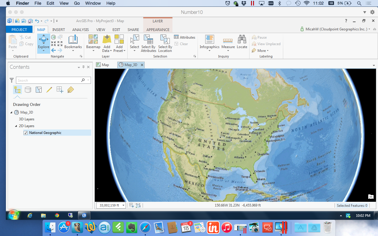
I had played with the Beta a while ago, and it didn't run too well on my current system. The display flickered & stuttered quite a lot and seemed to be constantly loading something. In anticipation for full release of ArcGIS Pro v1.0, I upgraded to the most current version of Parallels (10) and doubled my RAM to 16GB. Unfortunately, these easy answers didn't help with the display, I was still getting jumpy navigation and 3D felt like it was on Windows 2000. Great. Felt like i just blew $200 in upgrades. :-/
Last week during the Esri Business Partner Conference I spoke to a few virtualization experts who were demonstrating ArcGIS Pro on a virtual machine. (it seemed like they were there waiting just for me!) We spoke about my set up, there was a bit of nose-wrinkling but I looked around and pointed out about a dozen or so Macs throughout the Expo center. You have to do this when you talk about Esri software running on a Mac. Do I even need top point out how Apple was the only PC maker to have double digit growth in the past year? Point is there will be a lot of people trying to figure out how to run ArcGIS Pro on their MacBooks and the folks at the conference helped me out so I pass along that info to you:

Don't use open source virtualization. Virtual Box is nice if you aren't doing anything serious but doesn't have the options or horsepower that a production machine requires. VM Ware Fusion and Parallels are virtually identical in benchmark testing with ArcGIS Pro.
Do upgrade your RAM. I moved from 8 to 16 and dedicate a full 8 GB to my virtual machine. Parallels allows me do shave off another 2GB to the Video Memory still leaving 6 GB to run the MacBook.
Do use DirectX9 instead of 10. I know this is counterintuitive but the virtualization experts told me that ArcGIS Pro uses DirectX11 by default if it's available then jumps down to DirectX9. There is some compatibility issue with DirectX10. Parallels has options for OpenGL, DirectX10 and DirectX9. My video stuttering problems STOPPED when I chose DirectX9.
Do change ArcGIS Pro Display Options. Go ahead and monkey with the settings a little. Make sure your 3D accelerator matches your VM host. Enable Vertical Synchronization, and test the Speed --|-- Quality slider. I also set my system to delete the cache after I close the project.
Do use a host machine with a Nvidia Graphics card. MacBooks with Retina displays usually have one of these but you can check to make sure. Unfortunately, I do not. Download the 'Clear Sailing' Nvidia demo to test your system.
Final Notes:
Every system is a bit different. ArcGIS Pro is programmed to use a GPU if it's available. My Expert friends inform me that VMware Fusion leverages the GPU for 3D acceleration, but does not support GPU true pass-through. Parallels tries to create a virtual GPU by assigning RAM directly to 3D acceleration but it's not a direct GPU either. Look for this technology to keep advancing. I an a firm believer in SSD drives. I have two right now, one is completely for the Windows VM.
ArcGIS Pro Demo-nado
OK. The GIS World has had the much anticipated ArcGIS Pro for about 3 months now, and everyone is still using ArcMap. Why? Because change is hard.
Geo-Professionals should really change that, because ArcPro, Pro, ArcGIS Pro, AGP whatever-we-call-it is actually a pretty good product. YES, it has some shortcomings, as most first versions do. However, in a very unofficial tally from a group of 12 GIS professionals, the good outweighed the bad 8-5. Not a blowout be any means, but a positive result nonetheless.
It's no surprise that we (Cloudpoint) are behind the product. Ok, I am. I recently doubled my RAM in may MacBook in-part to be able to devote more speed to Parallels to run ArcPro. It runs well too! Drawing does slightly stutter when in 3D but that doesn't matter because I have yet to be convinced that my clients want or need 3D GIS.
I digress. This morning I created the two videos below in order to demonstrate ArcGIS Pro and several of it's best qualities (not 3D). The videos are fast paced, packed full and I kept them between 6 & 7 minutes. This is not GIS training, you can't train any person GIS in 7 minutes, let alone on a new piece of software. I hope you enjoy them and then download your copy of Pro to try it out.
In this first video of a two-part series, We simply walk around the interface and perform some SIMPLE actions. Opening a Map, Editing map notes and understanding what happens.
In this Second video of a two-part series, we will talk about importing an ArcMap MXD, Editing and touch briefly on navigating layouts.
Please leave a comment on YouTube if you like it.
Live Maps inside a presentation using Bunkr
If you have an ArcGIS Organizational account, you already have license to use Esri Maps for Office. It works really well and enhances your presentation from the boring screenshots of maps we have all grown numb to.
BUT! What if you don't have Microsoft Office? (there are a few of us) Or you use a MacBook or ChromeBook or UbuntuBook(?). Never fear, You can still embed your maps into a presentation using the Newly improved Bunkr App.

Bunkr has been around for a few years. However, they very recently Re-built themselves from the ground up. The streamlined tools and formatting will not appeal to those who are heavy powerpoint wingding/clipart/rainbow-font graphic users. It's a very minimalistic design. Which I respect, because presentations should focus on what the presenter is saying and slides should reinforce what is being spoken. Infact, I uploaded on of our graphic-heavy canned presentations and Bunkr essentially imported them as jpegs.
Instead, Bunkr focuses on web-data; stuff already on the web. Yes, it's cloud-based. No, you cannot download a presentation. No, there is not animation. Deal with it. You can however pull in Google Drive, Dropbox files, Instagram feeds, Pintrest boards, YouTube Videos, Grooveshark Playlists, Time/BBC/TechCrunch/Wikipedia Articles, images from anywhere, Code from Codepen ... and on... and on. Seriously, the current list is about 75 different online services and the application is still in beta. (You can open and read PDFs!)
Get to the Maps man!
At first I was excited to see the ability to embed code. That way I knew at least I could share a CodePen and display the results. I've played with that service before. Using it to keep, test and maintain good iFrames of embedded maps from our ArcGIS Online. In the example Bunkr presentation below, the first map is this CodePen. It works ~fine~ and the display isn't 'horrible'. Still, it is using another service to 'host' your iFrame, so there is some funkiness there, not everything displays exactly like you want.
Then I Learned that to display the Google Drive document, Bunkr requests the iFrame code directly. So, I tried the next logical step and inserted the whole code snippet from my shared ArcGIS Online map. BOOM! Complete slippy map in a presentation format. Here is the presentation to truly understand what I mean.
The only downside is that the code snippet is gone. You can't make those slight edits or adjustments on frame size. Once it's pasted and the slide is created, there's no editing. You just create a new slide and re-paste. So, I'll probably keep a list of embeddable iFrame code snippets somewhere, like I do now.

Awful presentations are usually the cause of fatigue and skipping out early on work. Engage your Audience with interactive maps.
You might be saying: "Seems like a lot of work to just display a ArcGIS Online map. Why not just link it to Your Powerpoint?" Well that's a valid point. However, if you want a smooth presentation and the ability to easily pull in MANY different sources from around the web, sometimes switching back & forth from Chrome to Powerpoint to Crome again gets tiring for the viewer. You've seen (or YOU have presented) those kind of maps, the presentation is constantly switching from browser to Powerpoint. And if the screen resolution is extended and they have to draa-aag the browser onto the correct screen, then eventually the presenter gives up and doesn't go back to presenter mode and just stays on the editing view.... ugh. you know what I mean? disconnected and confusing presentations are poor presentations.
That's really what makes presentations awful: Presenters don't often enough think about the audience.
A Look Forward: No Predictions, Only Productivity
Don't fall into the trap of thinking you know anything about the future. Sure, There's lots of neat confucus-iy quotes about knowing the future from learning about the past, or whatever. I've succumbed to the temptation myself to guess what will happen in the next 5 years. Here's the real deal. You can only control the "now". Even then just a little tiny corner of your world. The future is ever changing, take a lesson from Yoda.
Here at Cloudpoint, we are developing Principals to work by and not procedures or policies. We have no employee handbook or workplace guidelines. Even if we did it would be filled with bullet-point list of adages. For Example:
Be Professional.
Work Hard & Be Nice To People.
Are you Productive or Just Being busy?
Make it Better.
Why are you here?
When the door is shut, don't bother me.
Never Stop asking Questions.
When you feel like you can (or try to) predict the future, your pride gets in the way of actually making it happen. Somewhere inside you become a spectator watching life rather than a participant in it: "I knew this was going to happen!" Not helpful. A bit of personal humility can go a long way when you are assisting people with a new technology. Rather, when you set attainable goals you set a standard for yourself, a personal guideline. American author Mark Batterson once said (paraphrased): 'Goals are Just Dreams with Timelines' Well Said, Everybody needs dreams.
This is what 2015 looks like for us. These are our genericized Goals:
Increase Benefits to Team Members
Expand our Territory
Hire
7+ Speaking Engagements
Learn New Software
Read 13+ Books
Freely Distribute Several Useful tools
Centralize Cloud Offerings
There are others that I'm not willing to share, but this is most of the list from our first 2015 staff meeting. Some of them are personal, some are corporate all are real and attainable.
Don't let the lure of trying to predict the future fill you with apathy and pride.
What are your goals?