
Often times we are asked about the different solutions available from ArcGIS and how much they cost. Here is a summary of the different products and what they can offer your organization...
How can Your Mobile Device improve traffic sign maintenance?
Your first Drone flight: Secrets to success

Cloudpoint Aerial Services is a division of Cloudpoint Geographics, providing professional GIS and mapping services in the fields of surveying, engineering, transportation, utilities, and remote sensing. We are sharing some of our secrets of success to achieving professional, high-resolution aerial imagery using drones that will help you get up and running with your first drone (UAV) flight. This list is not all inclusive but gives you some key points that you will want to accomplish for providing quality aerial services with professional results.
Top 5 Geospatial Tips For your next vacation

This is a great website for planning your route and your stops. It has an excellent interactive map that allows the user to turn on and off layers including, hotels, restaurants, campgrounds, points of interest, natural wonders, parks, gardens, and more. It tallies your total mileage, travel time and includes an estimate for fuel expenses that updates as you alter your route. Depending on what your interests are, just turn on the layers and you'll be sure not to miss anything along the way.
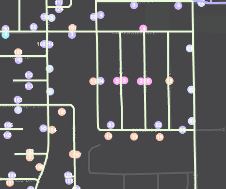
10 ways to use GIS for Sidewalk and ADA Compliance

Cleaning up the Waste with Optimized Routes!
Ever wonder if that route you run every day is the most efficient? Looking back, it all started when you found a map, grabbed your highlighter, marked it up and Voilà! From that day forth, your agency's routes were set in stone and they've been traveled over and over and over again ever since. You know that route like the back of your hand and of course its the most efficient because after all, you came up with it!
Well now with GIS tools such as ArcGIS Network Analyst for optimizing routes with the Vehicle Routing Problem Solver you may find that your old highlighted map is costing you lots of money in wasted fuel, time, and equipment ware. This post will take a brief look at the process optimizing routes for solid waste and recycle collection.
Step 1. Obtain point features for pickup locations

Garbage or recycle bins are located with GPS or geocoding methods and loaded into the GIS as point features to represent the various stops along routes. In this case the pickup locations were condensed to one point per street segment to allow for more efficient processing within the ArcGIS Desktop software.
Step 2. Generate Orders for Routing (condense if needed)

Creating optimized routes for thousands of pickups can take a considerable amount of time to process even with the latest hardware. For this example we used GP tools such as Create Route Event Layer and Generate Near Table to condense points along road segments and determine right or left side of street. This also allows for the pickup quantity field in the Orders class to be used as the number of cans along that side of the street. During this phase you will also place your 'depots' (starting and ending locations, including renewal locations such as landfills) on the map.
Step 3. Model Existing Collection Routes

By creating models of the existing collection routes within the GIS, we can confirm that variables such as travel times and service times are actually giving us "real-world" conditions and will provide credible results in our proposed routing models. Here we can see that the existing routes are very "block-like" and cleanly divided by neighborhood or subdivision. Looks pretty but not necessarily 'optimized'.
Step 4. Adjust Orders (pickup locations)
You may need to manually adjust some order locations and attributes as a result of modeling the existing routes to make sure the data is accurate and providing expected results with proper sequence of stops for the given route.
Step 5. Evaluate Various Scenarios and Select Optimized Routes

When processing the new routes, select various scenarios and compare those results to the existing routes to identify cost savings. For example, if the current collection program is running seven (7) trucks, try running a proposed model with only six (6) trucks and compare results. Cost saving measures are usually identified by total time or total distance. Once optimal routes have been selected, you will want to drive those routes as a quality assurance measure to be sure they are modeled accurately from the provided street network data.
Step 6. Using the Results
ArcGIS Network Analyst can generate turn-by-turn directions with detailed information on stops and estimated arrival and departure times. This information can be distributed to the drivers or entered into a GPS guidance applications such as Navigator for ArcGIS which will soon allow users to utilize their own pre-defined routes from ArcGIS Desktop or Online.
For more information or for a free quotation on optimizing routes for solid waste collection please contact Jon at 877-377-8124.
Is your GPS taking you the wrong way?

One day as I was working in my county engineer's office at Stark County, IL, a delivery driver stopped in and said "Why are these roads labeled incorrectly on my GPS map?" At first I blew it off thinking that's something beyond my control and I had more important things like ongoing construction projects. After all, we as the local agency were the knowledge experts on local names and places and if these big companies wanted our data they could "come and find us" with their "incorrect" GPS navigation devices. But then I realized what a tremendous benefit this would be to not only the local deliver driver but also emergency response, tourism, and many others.
So how do we get these basemaps updated? First of all, these basemap companies are BIG and there are only a few key players. By basemaps I mean the foundation for GPS navigation on consumer-grade electronics.
There's not exactly a 1-800 hotline that you can call as a one-stop-shop to update everyone in the universe (although that would be nice). There are however, tools that allow you to edit or update the information on your own. This is called crowd-sourcing, where anyone / anywhere can contribute to updating basemap information to benefit the traveling public. Here are some ways to do this for some of the bigger basemap providers out there:
A sample of an Esri basemap
- Esri Community Maps is a collaborative effort by Esri and the ArcGIS community to build the Living Atlas of the World
- Open Street Map is a crowd-sourced application that allows to edit and update street map information used by consumers around the world. All you need is to create a login and learn their simple editing tools.
- HERE, A Nokia Company, who recently purchased acquired Navteq is also a major provider of basemaps. With HERE you can go to their site:
https://mapcreator.here.com/mapcreator/ Map editing tool sign up for an account
https://content.ext.here.com/ Data upload portal (Upload GIS data here)
- Google Maps has a Base Map Partner Program that allows agencies to submit their data in vector format with specific instructions regarding format. In addition to vector data, Google also allows users to contribute to their collection of Cities in 3D, Imagery, and parcel data.
Remember, sometimes it takes some time for it to become active. Yes, real people typically look at the information you submit and actually take time to verify its accuracy.
If you have more ideas, thoughts, etc. please leave them in the comments below.
Because you can't fake accuracy...

You can fake your way through a lot of things in life. For example, you may be able to fool some folks into thinking you are a baseball expert by coaching a little league team. Make sure they know the steal sign, teach 'em to catch the ball, and not to swing at anything above their chin... and somehow everyone thinks you're some kind of pro.
So you don't necessarily have to be incredibly knowledgeable about the game or have pitched in the minor leagues to navigate your team through the season. But there are some things you can't fake, and one of them is GPS accuracy...
Like most GIS folks, you need a good quality GNSS receiver that connects to your mobile device via bluetooth? Most GIS folks don't need extreme sub-inch accuracy for their mapping project but they do want something that's better than the 8-10 feet they might see from their smartphone or tablet. Something in the middle like 3-4 feet would be nice (this area is shown to be a missing option as seen in this former post on GPS accuracy).
So let's take a look at some of the latest devices out there available in this realm...

The Trimble R1 GNSS receiver packs a lot of punch into such a small box. With Bluetooth capabilities for even more versatility.
1. Trimble R1 GNSS Receiver- a rugged, compact, lightweight GNSS receiver that provides professional-grade positioning information to any connected mobile device using Bluetooth® connectivity. Cost =. $2500
2. SXBlue II GNSS- The SXBlue II GNSS is a palm-sized receiver that delivers real-time, high accuracy performance using GPS/GLONASS satellites and free SBAS corrections. Cost = $2895.
3. EOS Positioning Systems Arrow Series 100 -The Arrow series 100 provides submeter accuracy for comparing with these other models but their line also includes the 200 model which claims to be the world’s first GNSS receiver able to provide 1cm real-time accuracy directly to your Android, iOS and Windows mobile device when connected to an RTK service or base station. Cost = $2995.
There are many different combinations and ways that you can collect high-accuracy GIS data with mobile devices. If you're looking for something that is lightweight and filled with performance, one of these units might be just what you are looking for. We hope to provide some more specific examples and possibly some accuracy reviews (nothing fake) in a future post.
A look back: Cloudpoint's 2014 Year in Review
First Flight: We've come a long way from Kitty Hawk, NC

First flight of the Wright Flyer I, December 17, 1903, Orville piloting, Wilbur running at wingtip. http://en.wikipedia.org/wiki/Wright_brothers

A close up of one of the props on Cloudpoint's first quadcopter which was later dubbed "Icarus".
It's been over 111 years since the birth of powered aviation and its amazing to think of where we've gone. Cloudpoint conducted its first successful GPS-guided aerial mapping test flight on June 9, 2014 at the Roanoke Apostolic Christian cemetery. Height: 150 ft, Speed: 6 mph, Flight time: 8 minutes
Mapping at Sonic Speed

Cloudpoint's new Chevy Sonic with almost the whole crew loaded inside.
In July we purchased our first company vehicle, a Chevy Sonic, from Sam Leman in Eureka, IL. The logo and lettering by Kat-n-Mouse Graphics of Roanoke. This has been a great vehicle for us as we put many miles on traveling throughout the state to our various clients.
Signs of Success

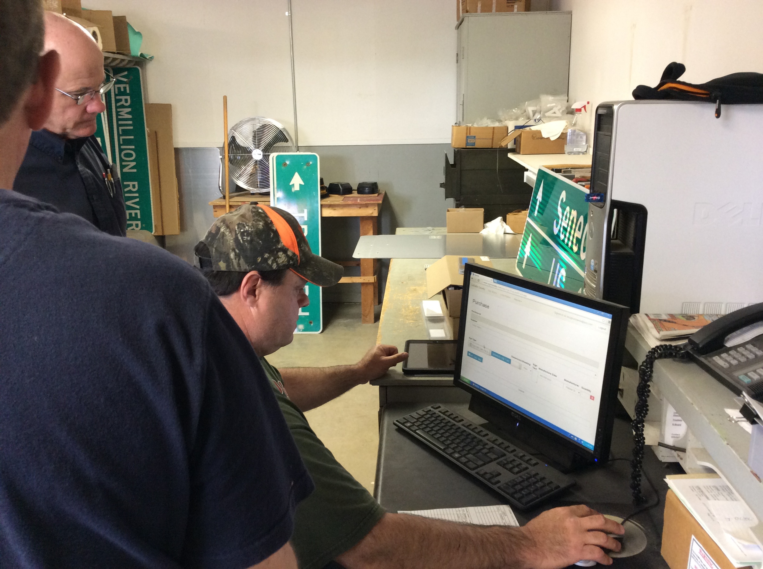
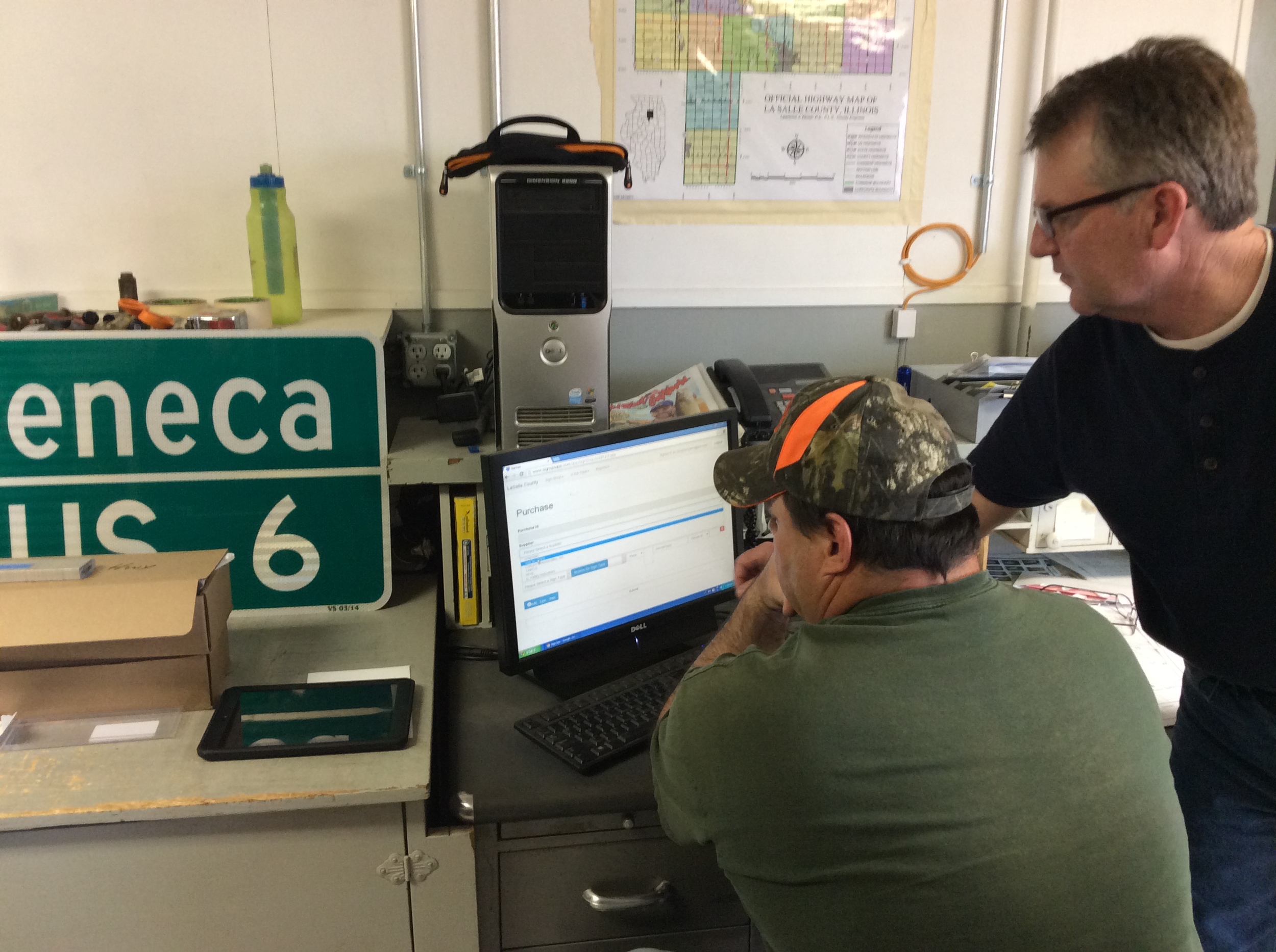


On May 1 we successfully rolled out our first custom application solution called SignOps, a sign inventory management solution using barcode tags for asset management. LaSalle County was the first project where we tagged over 6,000 signs with barcodes and provided a complete turn-key mangement solution with the SignOps application.
What are we up to in the next 30 days?
October will be a busy month for us! We have several upcoming conference events that we will be at and hope to see you there. Be sure to stop by our booth for a visit if you are attending any of the following:
October 9, 2014- IACE (Illinois County Engineers Association)- Peoria, IL (40.693932 , -89.591996)

Here you can catch us at our booth or providing GIS training for the County Engineers. As part of a new technology twist, the association has decided to offer GIS training as part of this year's conference. Micah and Jon have some great experience to share as former County officials and will provide a hands-on look at the latest GIS applications available for highway engineers and a lot of "how-to's" mixed with it. Also don't forget to check out SignOps, our latest sign inventory maintenance solution.

Micah Will be presenting at the Wisconsin Esri Users group in Wisconsin Dells on October 20 & 21st. He will be giving a talk on ArcGIS Online for daily use similar to on given in Springfield Illinois last month in August. Since there will be several of our esteemed Esri colleagues present, hopefully he'll keep the ribbing to a minimum (hint-hint).
October 27-29, 2014- ILGISA (Illinois GIS Association)- Lisle, IL (41.807391 , -88.110383)
Jon will be speaking on at this conference on Tuesday about using the parcel fabric and Matt will be sharing about GeoEvent Processor. We also plan on giving away something "really big" as a door prize so don't miss out.

October 28-29, 2014- ILRWA (Illinois Rural Water Association)- Utica, IL (41.315869 , -89.01107)

We always appreciate the relationships that we have formed with the good folks associated with ILRWA. Some of our best clients were generated as leads from this group and we continue to see them each year supporting this great organization.
10 Reasons to migrate to the Parcel Fabric
As many of you know, the parcel fabric concept has been around for quite some time but many have been slow or hesitant to adapt to it. In this entry, we would like to take a brief look at some of the advantages of using the fabric and try to answer some questions such as "Why should I migrate to the parcel fabric?" or "What real benefit will I receive from an ArcGIS solution for maintaining parcels?". If you haven't already done so, chances are you will soon be taking a serious look at what it takes for you to migrate your polygon parcels into this model.
1. It's A platform solution- One of the clear advantages of having a platform solution is that you don't have multiple vendors supplying multiple solutions. You already use the ArcGIS platform and pay a healthy maintenance subscription so why not take full advantage of the dollars you have invested in your COTS (commercial-off-the-shelf) solution. You will not only save money from that end but there is a good chance you will be on the same page as your neighboring agency.
2. Everything is tied together- If you have been maintaining your parcels in a simple polygon layer you have undoubtedly found times when you have overlap in your polygons. This can cause many frustrations when editing and not to mention the spatial inaccuracies that come along with it. The fabric avoids overlaps by allowing your parcels and boundary lines to "move" all together. Instead of adjusting 4 different polygons when a corner point moves, why not tied it together so you only make one change everything else adjusts to that change. The fabric allows you to make these adjustments with ease saving you time and money.
3. The Parcel Editor Toolbar- esri has the parcel editor toolbar available as a free add-in that contains multiple tools and menu commands that help simplify the workflows involved with maintaining parcels and control points.

4. Parcel Workflows- The Parcel Editor Toolbar also contains a menu for automating parcel editing workflows. Merging parcels, splits, subdivisions, imports from CAD, and boundary line adjustments are all made easier using these workflows.
A screen shot of esir's Tax Parcel Editing Map template
5. Tax Parcel Editing Map- All of the parcel types, whether, tax parcels, subdivisions, lots, or encumbrances (also known as easements) are stored in the fabric as one feature class, however they are separated by types and layers in a sample map you can download know as the Tax Parcel Editing Map.
6. The Plan Directory- Another freebee built into the parcel fabric data model is a table for storing information about record drawings, plans, survey plats, or other legal documents used by surveyors and engineers to describe their findings. This related table allows for user-friendly entry and interaction with the plan's corresponding parcels to store information such as Name of Surveyor, Survey Date, Document/Plan Numbers, etc. You can create and maintain plan record information for each parcel or subdivision within the fabric or take it one step further and link the source document directly to the GIS.
7. Spatial Accuracy- You might be telling yourself "I really don't need survey accuracy for my parcels" but with each control point you add to the fabric, whether from the City/Town, County, Private Surveyor, or Federal sources; it allows you to refine and adjust your parcel fabric for greater spatial accuracy. Its not uncommon to adjust your fabric over time and achieve spatial accuracies down to just a few inches or less with respect to the real world.

The historic parcel layer helps keep a record of past changes and is automated from the workflows.
8. Historical Parcels- Many times we hear of the need to go back and look at what the parcel ID's or layout prior to a split or annexation. The parcel fabric has a layer specifically designed to maintain the historical parcels and the great thing is that its completely automated. When you step through the workflows it will prompt you if you want to create historic parcels from your new changes and by doing so it keeps a well documented history of your land records.
9. Local Government Information Model (LGIM)- The fabric allows you to enable information models such as the LGIM which many are already using. This may save you a lot of time up front so you don't have to 're-invent the wheel' providing out-of-the-box tools for working and interacting with your other land record data layers.

Here is a parcel that has been subdivided into lots and easements including drainage, utility, and ingress/egress.
10. Standardization- Isn't it nice when we are all on the same page and speaking the same language. Using the parcel fabric allows us to have a consistent form of naming convention and storing data to help when we are interacting with our 'neighbors' or as GIS users or managers transition in and out of jobs its nice to have familiar data formats to build upon.
As you continue to expand your use of GIS technology, I hope you will find the parcel fabric as a very useful tool for maintaining land records in a clean and simplified format. We will be discussing the process of migrating your data to the parcel fabric and explain some "do's and don'ts" in an upcoming post.
Piecing the Plots together: High-Accuracy cemetery GIS
It's safe to say that the smaller the block, parcel, or lot; the more difficult it can be to accurately represent your features in a GIS system. When it comes to cemetery lots, this can be just the case as we start to go from feet to tenths to inches. If your objective is to just locate a grave with respect to a certain area or section within the cemetery, then maybe a simple smart phone app searching for relative points may be all you need. However, if you need to see the layout of lots, blocks, and graves, using polygons to identify specific graves (which may be the case for cemetery management tools) then high-accuracy GPS is the way to go.

This sample project consisted of collecting cemetery markers with a Trimble Geo-XH 6000 (cm Edition) GPS unit to obtain high-accuracy coordinates which were used as control points to lay out the blocks, lots, and graves or the cemetery. Once the layout was completed, GIS data was populated from an existing database of information obtained from personnel responsible for managing the cemetery. OK, so your next question is "where does the high quality imagery come from?". Google??? NO, this was actually collected with a unmanned aerial vehicle (UAV or commonly known as a drone) outfitted with GPS guidance and a professional grade camera. You can read more about the drone project in separate upcoming blog. The surrounding ground around the cemetery markers was painted with a white "X" to be used as ground control points when stitching the photos together. The final map was served up as a feature service on ArcGIS Server and can be searched by last name using the magnifying glass search tool in the top right corner. Notice how the head stones appear in the aerial image with precise accuracy over their designated grave polygon. There will be more on these tools and methodology to come.
Roanoke Apostolic Christian cemetery location...
Getting Attachments down from ArcGIS Online
The ArcGIS Marketplace (Maps & Apps)
Just wanted to keep everyone abreast on the latest information when it comes to ArcGIS Desktop and ArcGIS Online applications.
The ArcGIS Marketplace provides a way to access maps & apps from Esri, distributors, and partners. The Marketplace contains both free and paid apps that are designed to help your organization access and share your GIS data seamlessly with either in-house staff or the public. Similar to Apple's app store or Android apps found on Google Play, the ArcGIS marketplace is intended to be a one-stop shop for your Esri based mapping needs.
Topology & Geometric Networking... Say What???

These are two big words often used in the geospatial world but who really knows or cares what they mean? Well now you can alllow yourself to be "In the Know".
Topology is the arrangement for how point, line, and polygon features share geometry. In other words, it's provides a means to make sure all of your pipes are connected to all of the network structures such as valves, hydrants, and/or manholes, etc. In addition you can make sure that there are no improper overlaps or intersections as in a tax parcel layer so your maps accurately represent what's out there in reality.
LIDAR: So how good is good enough???
So what's my accuracy??? Mobile Device GPS with iPad, iPhone, & Android

If you have ever been involved with a GIS project that requires data collection using a handheld device there is no doubt that you at some point ask yourself "Is this spatially accurate enough?". Well here is some evidence that proves those little tiny GPS chips within those smartphones are actually pretty good.
So you can't afford to replace your Traffic Signs?

Some people worry that they have to replace all of their street or traffic signs that are not in compliance with the minimum retroreflectivity requirements as set forth in the Manual on Uniform Traffic Control Devices (MUTCD). However, this is not always the case. The objective of the guidelines is to get street departments, public works officials, and transportation agencies to establish a management method to maintain their signs.
Getting beyond the electric fence with a Trimble Geo XH...

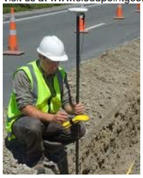
So how do you get a highly accurate GPS location on something that is not accessible??? Using the Trimble Geo XH 6000 series and Terrasync (cm) Edition we are able to use the "Offset" command in the Data collection tools within Terrasync software. We simply tell the unit that the point is exactly 10 feet south of our current location and we start collecting data.
So Where are Your Underground Utilities?
How do you find your underground utilities? Does your method of relocating them consist of your veteran public works director and the third-generation local excavator estimating them based upon a combined 70 years of memory? We find this all to common in today's communities where their baby-boom staff will soon retire and take with them an incredible amount of "tribal knowledge". Although they may have an incredible ability to tell where those 50 year old lines are at, someday these folks will not be available. That's why mapping these utilities with GPS equipment is so critical! Don't lose all of that valuable information, you just can't take that risk. It doesn't have to be expensive equipment that costs thousands of dollars. Even a simple $200 Garmin eTrex will get you headed in the right direction. Today's GPS equipment can provide accuracies that vary from five feet to five millimeters.In addition, if you are a local government agency that has a permitting process for underground utilities, why not start requiring the permittee to provide you as-builts with GPS coordinates. You can do this with a simple ordinance update and even specify the accuracy requirements, and they don't have to be overly tight. This is not an unreasonable request and will not place an "undue" hardship on them when the cost of GPS equipment is so insignificant these days. The point is once you have the data it can be used in so many different capacities. So why not set your agency on the right course today and make things better for the next generation!
Visit us at www.cloudpointgeo.com